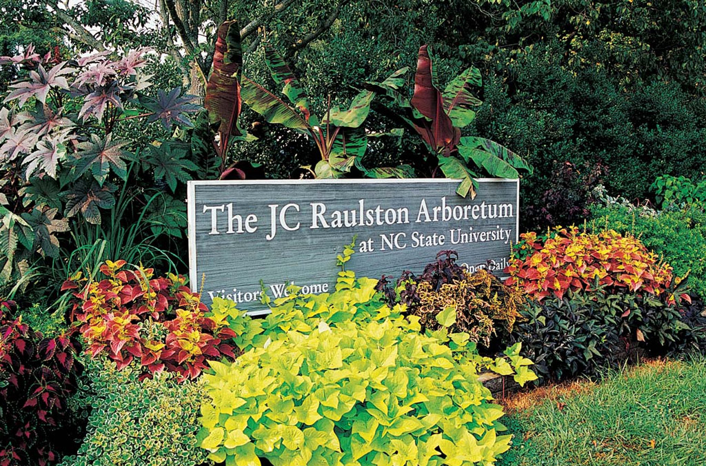
For my capstone project, I had the opportunity to partner with the JC Raulston Arboretum in Raleigh, North Carolina. The arboretum houses one of the largest and most diverse collections of landscape plants in the southeastern United States. Managing information for such an extensive plant collection, along with accommodating a growing number of visitors, requires effective software and data management systems. More often than not, these systems need regular maintenance, troubleshooting, and optimization. My role in this project was to enhance operational efficiency of the database, reorganize spatial data, and optimize the arboretum’s web mapping applications.
Problem
The primary problem addressed in this project involved enhancing the geospatial data management and web application capabilities of the JC Raulston Arboretum (JCRA) in Raleigh, NC. The arboretum faced challenges with its dual-database system: a FileMaker database for non-spatial data and a Postgres database for spatial data, which had a delay of up to one minute for updates to synchronize. Additionally, the spatial database required cleanup and reorganization to address fragmented layers, redundant data, and missing attributes like ADA accessibility. The existing web mapping applications also lacked usability and design optimizations, making them less effective for visitors and staff. The purpose of the project was to streamline database synchronization, reorganize and enhance spatial data, and create intuitive, user-friendly web applications tailored to the needs of visitors and staff.
Analysis
To address the synchronization delay, I installed and configured PostgREST, an open-source web server that transforms a Postgres database into a RESTful API, allowing instantaneous data read and write operations. This solution was tested and secured with authentication. For spatial data reorganization, I merged fragmented path layers, collected field data on materials and ADA accessibility, and digitized missing features such as paths, lawns, and ponds using ArcGIS Pro. These layers were then enhanced with additional attributes and organized into an Enterprise geodatabase.
To improve the web mapping applications, I published spatial data as map and feature services using ArcGIS Server and developed two ArcGIS Online maps—one read-only for visitors and one editable for staff. These maps were integrated into custom web applications using ArcGIS Experience Builder, focusing on mobile optimization for the visitor app and advanced editing functionalities for the staff app. Symbology, labeling, and search tools were also refined to enhance user experience.
Results
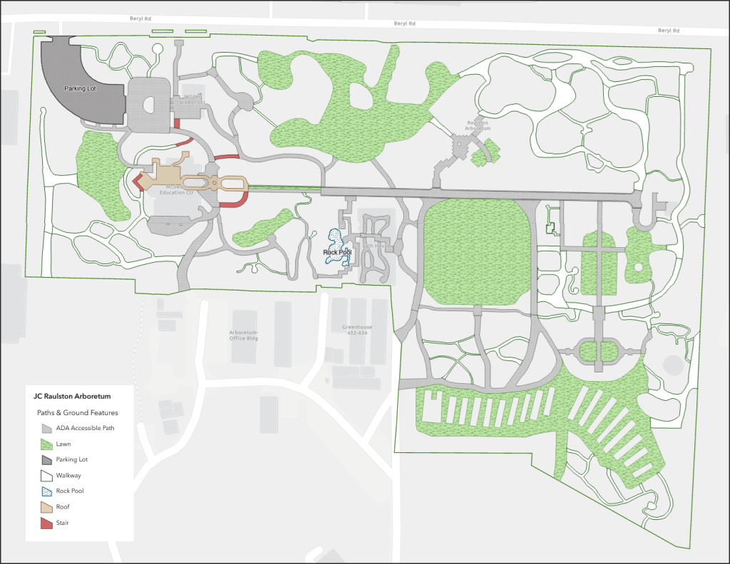
The project delivered several significant outcomes. The synchronization issue between FileMaker and Postgres was resolved, allowing instantaneous updates. The spatial database was consolidated, reducing redundant layers and incorporating critical attributes like ADA accessibility and material types for paths (Figure 1).

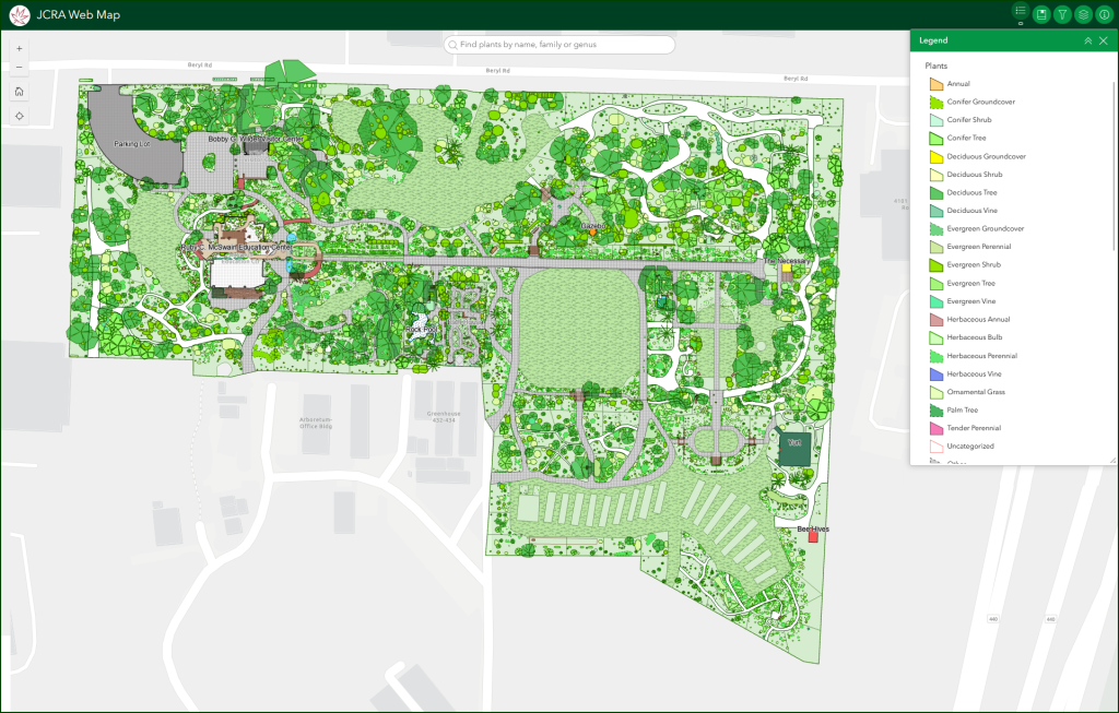
Two web mapping applications were created: a visitor-friendly app optimized for mobile devices (see Figure 2) and a staff app with secure access and advanced editing capabilities. These tools provided an intuitive way to search for plants, view detailed information, filter data, and navigate the garden effectively. Visual components such as interactive maps, intuitive bookmarks, and responsive labels made navigation and information retrieval easier for all users. While the applications are functional, further work is needed to optimize map loading times.

Reflection
This project significantly enhanced my technical and professional competencies. I gained hands-on experience with RESTful API implementation, cURL, database management, and geospatial application development. I also refined my skills in ArcGIS Pro, ArcGIS Server, and ArcGIS Experience Builder, building solutions that addressed real-world problems. Collaborating with the arboretum staff and other stakeholders taught me the importance of user-focused design and iterative feedback in project development.
The skills I acquired during this project are highly transferable and valuable for future GIS and web mapping projects. Beyond technical expertise, this experience deepened my understanding of the challenges organizations face in managing geospatial data and tools. It underscored the importance of maintaining accessible, user-friendly systems for diverse audiences. Overall, this project reinforced the value of integrating technical solutions with practical user needs, a lesson that will continue to guide my work in the geospatial field.
Link to Web Map
https://experience.arcgis.com/experience/7ca50744a75149ea810f5dc5557fdcf5